
By: Lukas Mueller, P. Eng, River Engineer
Environmental approvals often hinge on a reviewer’s confidence that proposed ecological objectives will be achieved. Whether the goal is maintaining fish passage, preserving hydraulic connections between wetlands and watercourses, supporting habitat function, or ensuring channel velocities remain within acceptable limits, reviewers frequently seek out technical evaluations that support these goals.
That’s where 2D hydraulic modelling comes into the picture. This technology provides a more defensible, quantitative assessment of conditions compared with simple empirical methods or 1D hydraulic modelling. 2D hydraulic modelling allows for the simulation of various flow conditions over the proposed restoration surface. By demonstrating that ecological objectives are likely to be met under a range of flow conditions, modelling can help reduce uncertainty during the review process, address technical questions early, and support a more efficient path toward project approval. Keep reading to learn how.
Asking Questions on Behalf of the Environment
One of the most valuable uses of 2D modelling is that it allows designers to measure quantitatively how well design elements will perform rather than relying solely on professional judgement or assuming they will work as intended. With 2D modeling, reviewers can examine measurable outputs such as water depths, velocities, and flow paths to verify that ecological objectives are likely to be achieved.
For example, a restored channel beneath a bridge crossing may satisfy velocity, stability, and conveyance requirements, and theoretically demonstrates fish passage based on a peak flow (i.e., as a snapshot in time). However, that does not automatically mean that fish can successfully move through the reach.
A 2D model allows velocity patterns to be evaluated across the entire reach, rather than at a handful of cross sections. The model can be used to identify low-velocity pathways, map areas of refuge, and quantify the longitudinal spacing between these areas of refuge. Then, armed with the knowledge of swimming abilities of targeted native fish species, specifically swim speeds and how long these speeds can be maintained, it becomes easier for the designer to make conclusions about whether the crossing will support fish passage.
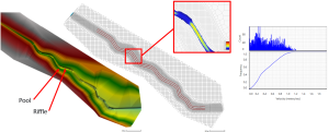
Similarly, a riparian wetland may be incorporated into a restoration design as an ecological enhancement. The design drawings may look reasonable, but will the wetland receive sufficient flow often enough to remain connected to the channel? A targeted 2D analysis can help answer that question by evaluating frequency of inundation, testing various inlet and outlet configurations, and identifying refinements to the design before construction.
In both examples, the model is helping reduce uncertainty about environmental performance, not just addressing a regulatory requirement.
The Model Does Not Need to be Perfect
One lesson I learned from these projects is that the value of a model is not necessarily related to its complexity.
Large models can require significant effort to develop, calibrate, and troubleshoot. In a consulting environment, that level of effort is often not practical. Fortunately, restoration projects typically begin with something many other modelling exercises do not: a detailed digital representation of the proposed design. Because this work is already completed as part of the design process, a 2D model can often be developed much more quickly than expected.
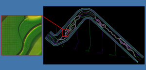
Rather than spending days building a model from the ground up, the proposed channel, floodplain, or wetland can often be imported from CAD software directly into most 2D hydraulic modeling software (i.e., HEC-RAS, River2D or MIKE 21).
The ease with which a model mesh can be generated and updated to reflect topography, channel geometry, grading, and proposed restoration features also allows for iterative testing of temporal and spatial resolution. Resolution, storm length, and terrain complexity all influence model performance and runtime, and the relative simplicity of the model allows these parameters to be optimized and tailored to the needs of the project.
The Need for an Interdisciplinary Skillset
Building a model is only part of the challenge. Interpreting the results is often where the most important decisions are made. How do we know if the mesh is adequately representing the design? Should we spend hours resolving a downstream boundary condition, or can we demonstrate that it has little influence on the area of interest?
Experienced practitioners are often able to distinguish modelling artefacts from meaningful results, allowing them to focus effort on uncertainties that influence the environmental question at hand and avoid time resolving inconsequential numerical behaviour. The goal is not to eliminate uncertainty, but to identify the uncertainty that controls the design decision.
When hydraulic modelling is combined with an understanding of geomorphology and ecology, it becomes more than a regulatory or engineering exercise. It becomes a practical tool for asking environmental questions that might otherwise go unanswered and for designing restoration projects that are informed not only by hydraulic performance, but by ecological function.
Thinking about a restoration project? Contact me and let’s talk about what 2D modelling can reveal before construction begins.


